
Artículos de investigación
Published 2021-10-02
Keywords
- Leo Belgicus,
- iconography,
- iconology,
- geographic charts,
- Netherlands
How to Cite
González de la Torre, Patricia Monserrat. 2021. “Leo Belgicus: Iconography, Geography and Transitions of Reality”. Bloch. Revista Estudiantil De Historia 1 (2):40-52. https://revistabloch.uanl.mx/index.php/b/article/view/61.
Copyright (c) 2021 Patricia Monserrat González de la Torre

This work is licensed under a Creative Commons Attribution 4.0 International License.
Abstract
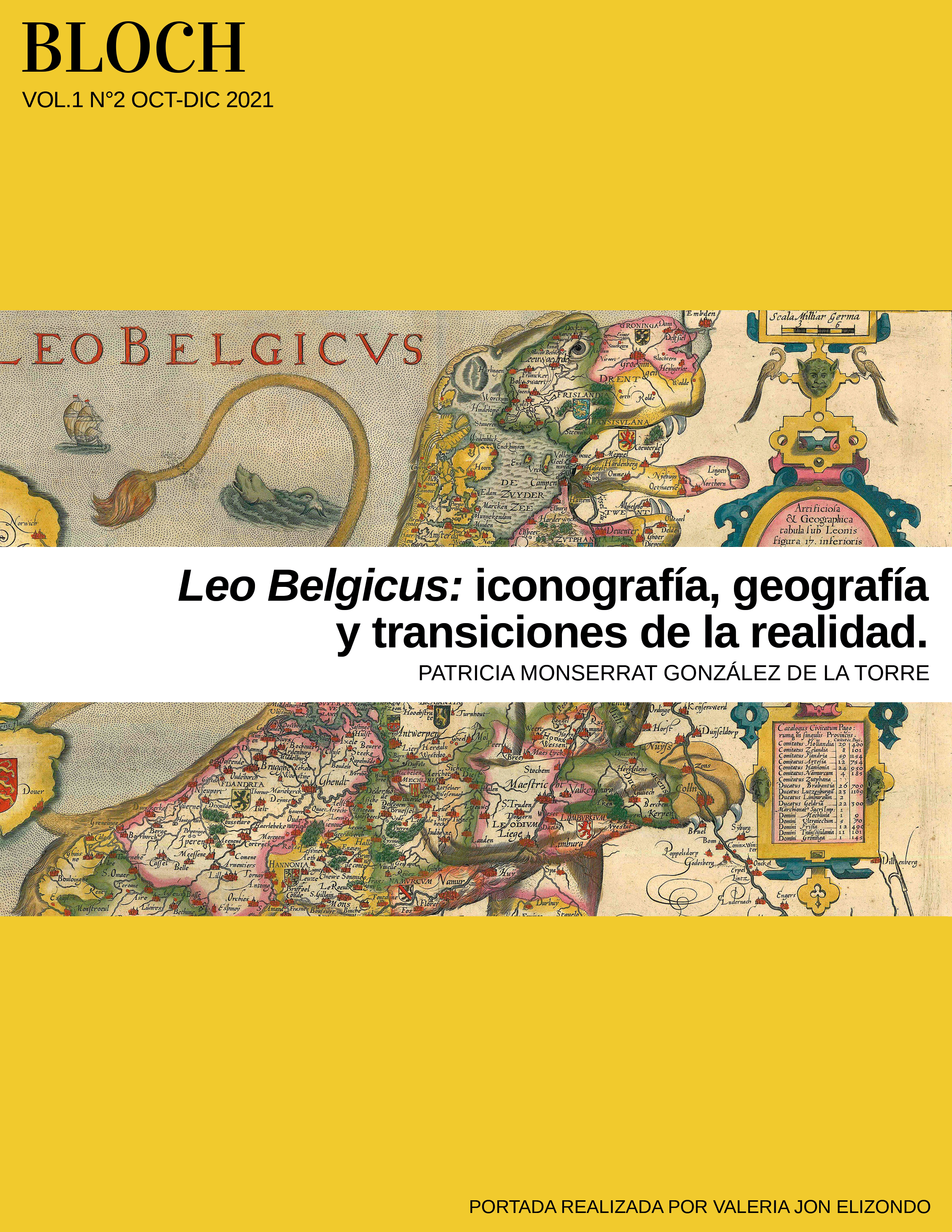
The present work consists of a brief analysis of two geographical charts designed between the 16th and 17th centuries in which the territories of the Netherlands were mapped. Such maps, better known as Leo Belgicus, will be understood not only as representations of cartography, but as documents that narrate and manifest through their iconographic content the particularities of the context in which they were created, as well as their transitions.
Downloads
Download data is not yet available.
References
- EehrenBerg, R. (2006). Mapping of the world. An Illustrated History of Cartography. National Geographic.
- Harley, J.B. (2005). La nueva naturaleza de los mapas. Ensayos sobre la historia de la cartografía. Fondo de Cultura Económica.
- Israel, J. I. (1997). La república holandesa y el mundo hispánico 1606-1661. Nerea.
- Kinder, H. y Werner H. (2007). Atlas histórico mundial. De los orígenes a nuestros días. Akal.
- Melion, W. S. (Ed.). (2015). The Anthropomorphic Lens. Anthropomorphism, Microcosmism and Analogy in Early Modern Thought and Visual Arts. Brill.
- Monmonier, M. (1996). How to lie with maps. The University of Chicago Press.
- Panofsky, E. (2006). Estudios sobre iconología. Alianza Editorial.
- Raisz, E. (1985). Cartografía general. Ediciones Omega.
- Ricci, A. (2015). Maps, Power and National Identity. The Leo Belgicus as a Symbol of the Independence of the United Provinces. Bollettino dell'Associazione Italiana di Cartografia, 154, pp. 102-120.
- Stanford Libraries. (2021). Novissima, et Accuratissima Leonis Belgici, Seu Septemdecim Regionum Descriptio. Universe of Maps – Opening the David Rumsey Map Center. https://exhibits.stanford.edu/david-rumsey-map-collection/catalog/gr074nv3804.
- Tenenti, A. (2011). La Edad Moderna XVI-XVIII. Editorial Crítica.
- Tenenti, A. (1989). La formación del mundo moderno. Editorial Crítica.